Guidepost

The planner

What your visitors would be using

Everything below is working today. These are pictures of the real planner; we show it live on a walkthrough.
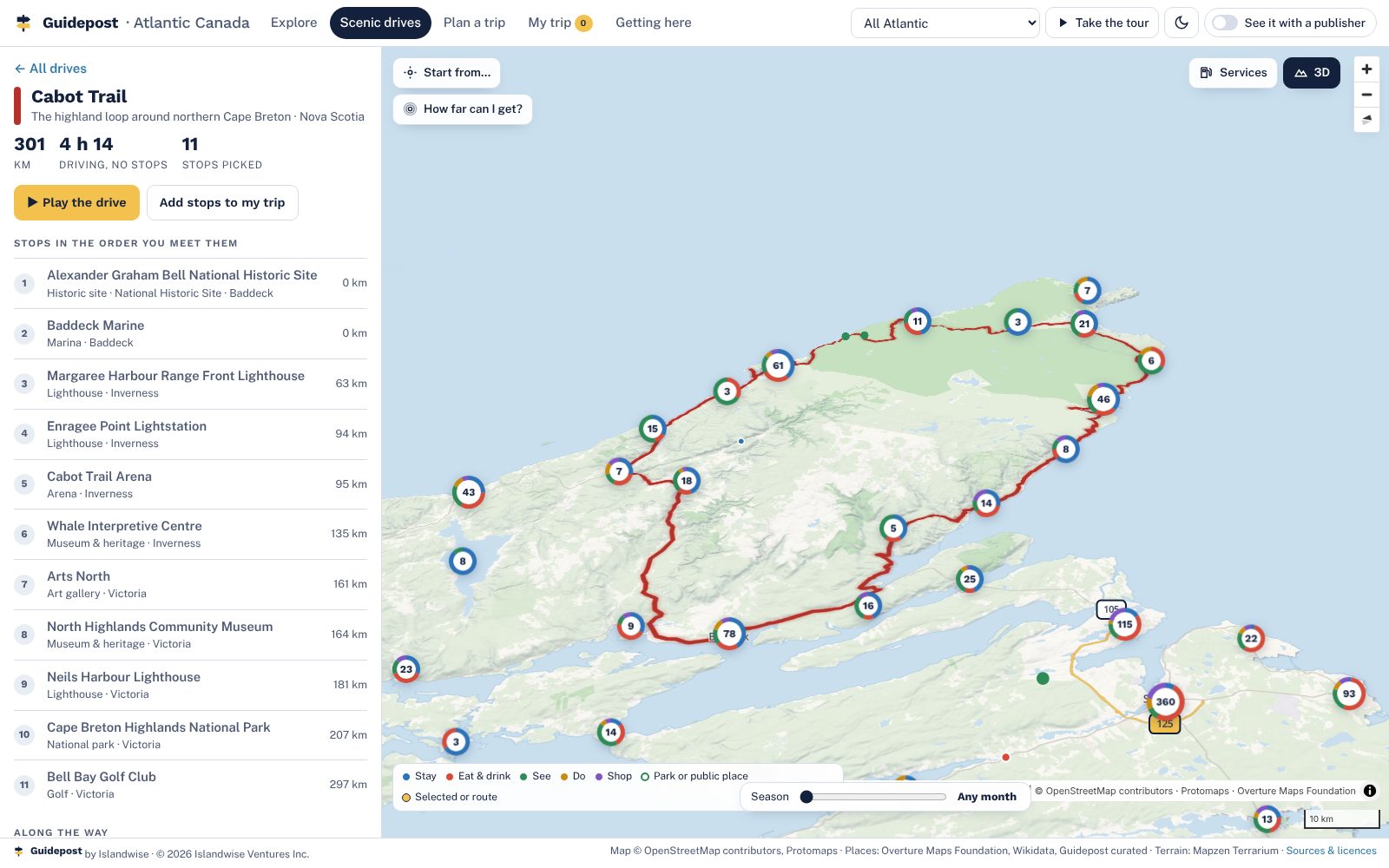
The Cabot Trail drawn in red over 3D terrain of the Cape Breton Highlands, with the drive's stops listed in order
A real map, in 3DVector tiles for all four provinces with hillshade, terrain and buildings you can tilt and turn. Street detail across PEI, Nova Scotia, New Brunswick and the island of Newfoundland, with full town detail in about 400 towns and the main corridors, and finer relief over the Cape Breton Highlands, the Fundy cliffs and Gros Morne. Labrador is mapped at overview detail.
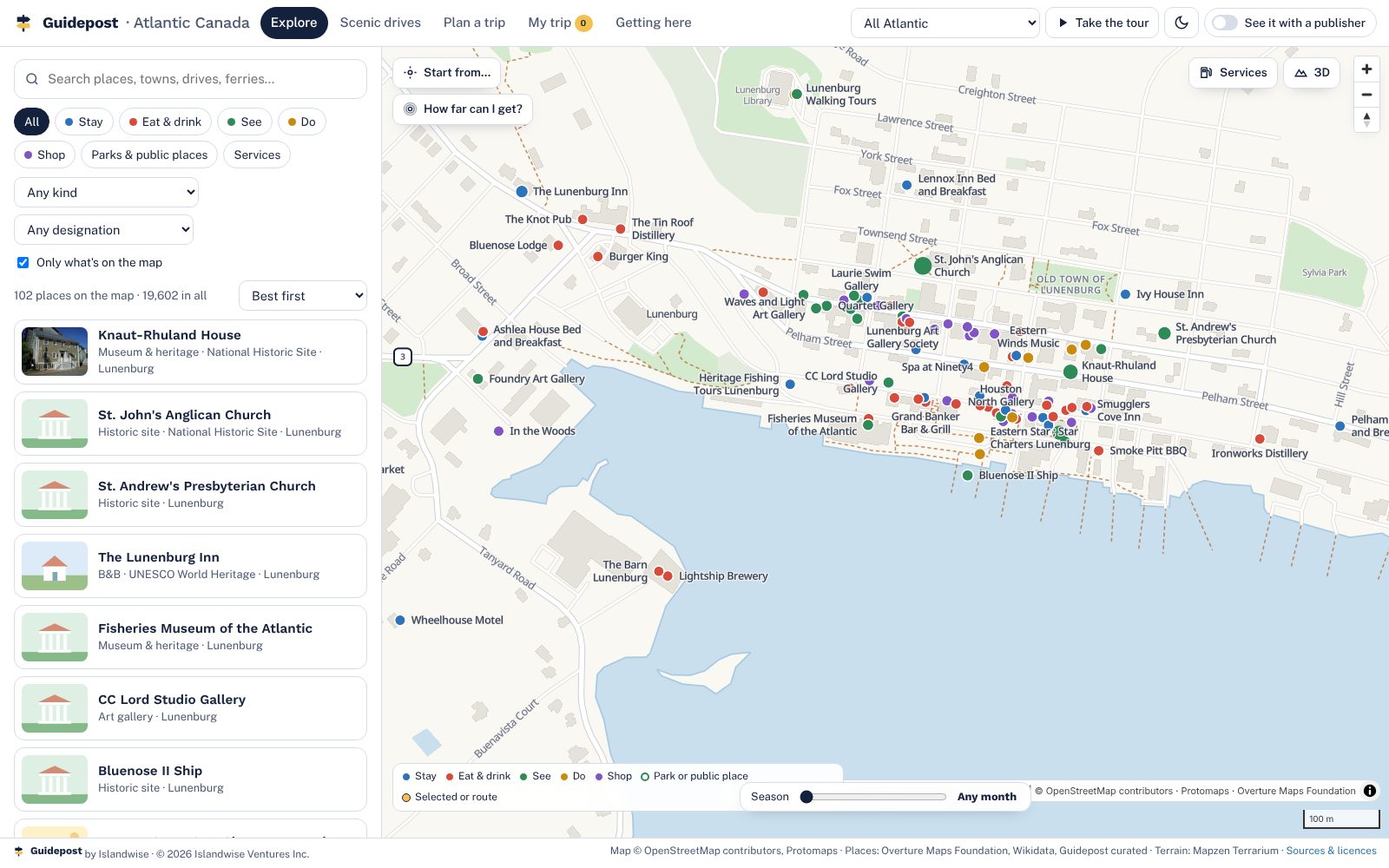
Lunenburg's waterfront at street level, with streets, buildings and Guidepost places labelled clear of each other
Clean all the way inAt street level the map turns to plain paper with crisp streets, buildings, shorelines and labels, in town and country alike. No blurred patches where the data runs out.
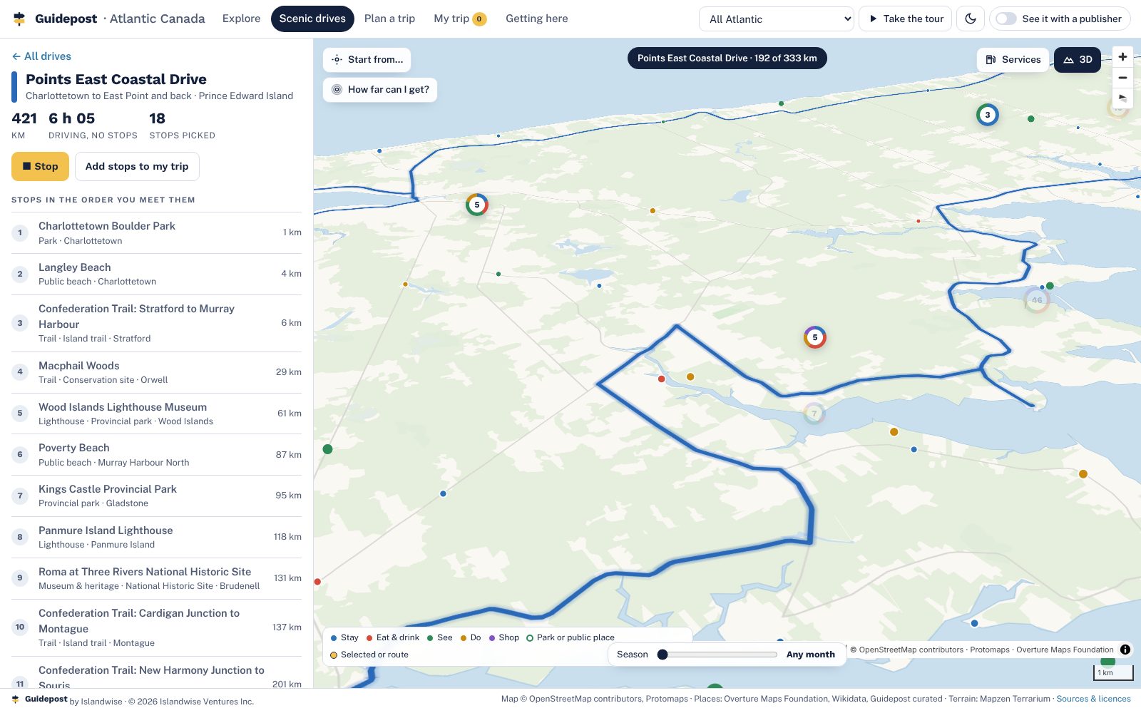
The Points East Coastal Drive being played as a camera flight along the road
26 scenic drives, playedEvery official touring route in the four provinces, with length and drive time from the road network, stops in the order you meet them, and a camera flight along the road.
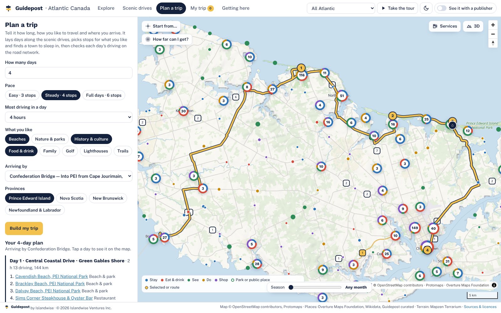
A four-day plan from the Confederation Bridge with a route drawn on the map and a bed each night
A planner that builds the daysLength, pace, interests and where you arrive. It lays days along the drives, finds a town to sleep in, checks each day's driving on the road graph and warns when a day runs long.
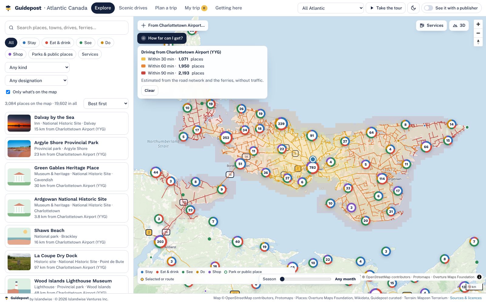
Drive-time rings of 30, 60 and 90 minutes from Charlottetown Airport with the places inside each counted
How far can I get?Thirty, sixty and ninety minutes from any start, bridge and ferries included, with the count of places inside each ring. Worked out in the page, no server.
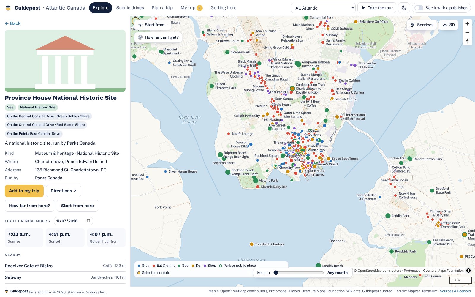
A listing sheet for Province House National Historic Site with sunrise, sunset and golden hour, nearby places and the data source
A listing sheet for every placePhoto with its credit, designation, address, website, season, sunrise and sunset for any date, what's nearby, and exactly where the record came from.
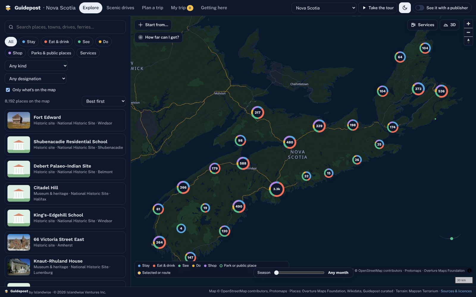
Nova Scotia in dark mode with donut clusters coloured by category
Clusters that tell you what's thereDonuts coloured by stay, eat, see, do and shop that split as you zoom. Light and dark, and a search that forgives typos and accents.
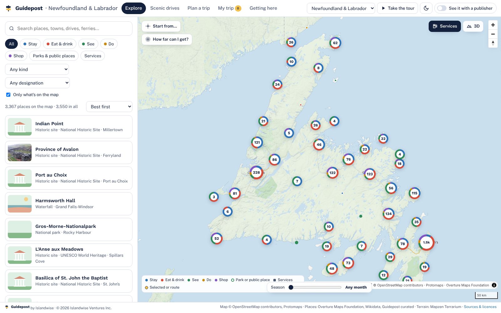
Newfoundland and Labrador with the services layer on
Seasons and servicesA month slider greys out what's closed, where the season is known. A services layer for gas, EV charging, groceries, pharmacies and hospitals, off until you need it.
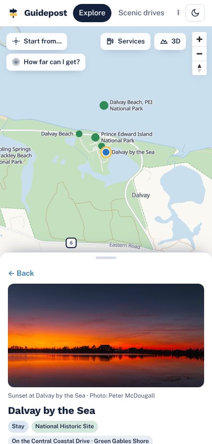
The map on a phone, with the panel as a bottom sheet
Phone first, counter and presenter modesOn a phone the panel is a bottom sheet. A kiosk mode for visitor-centre counters hands a visitor their trip as a code to scan.

Your layer

What a publisher puts on top

You
Picks, deals, tours and guidesYour editors choose what sits on top of the map and when it changes. Your advertisers' offers show on their listings. Your printed guide, page by page, with every listing linked.
You
Advertisers first, with one-tap bookingYour advertisers lead the results in their category and book through the partners they already use. A placement in the guide is worth more than it was.
Both
Counter mode and the QR on every coverA card at the visitor-centre desk and a code on the guide: the visitor scans, the week is on their phone. No app to install.
Us
The base map, hosting and updatesEvery place, the map itself, routing, the planner, the season report. Kept current by Islandwise; you never touch a server.
Where Guidepost shows: once, small, as "powered by Guidepost" at the foot of the planner and on the counter card. Never in your header, never on your cover beyond the QR badge.
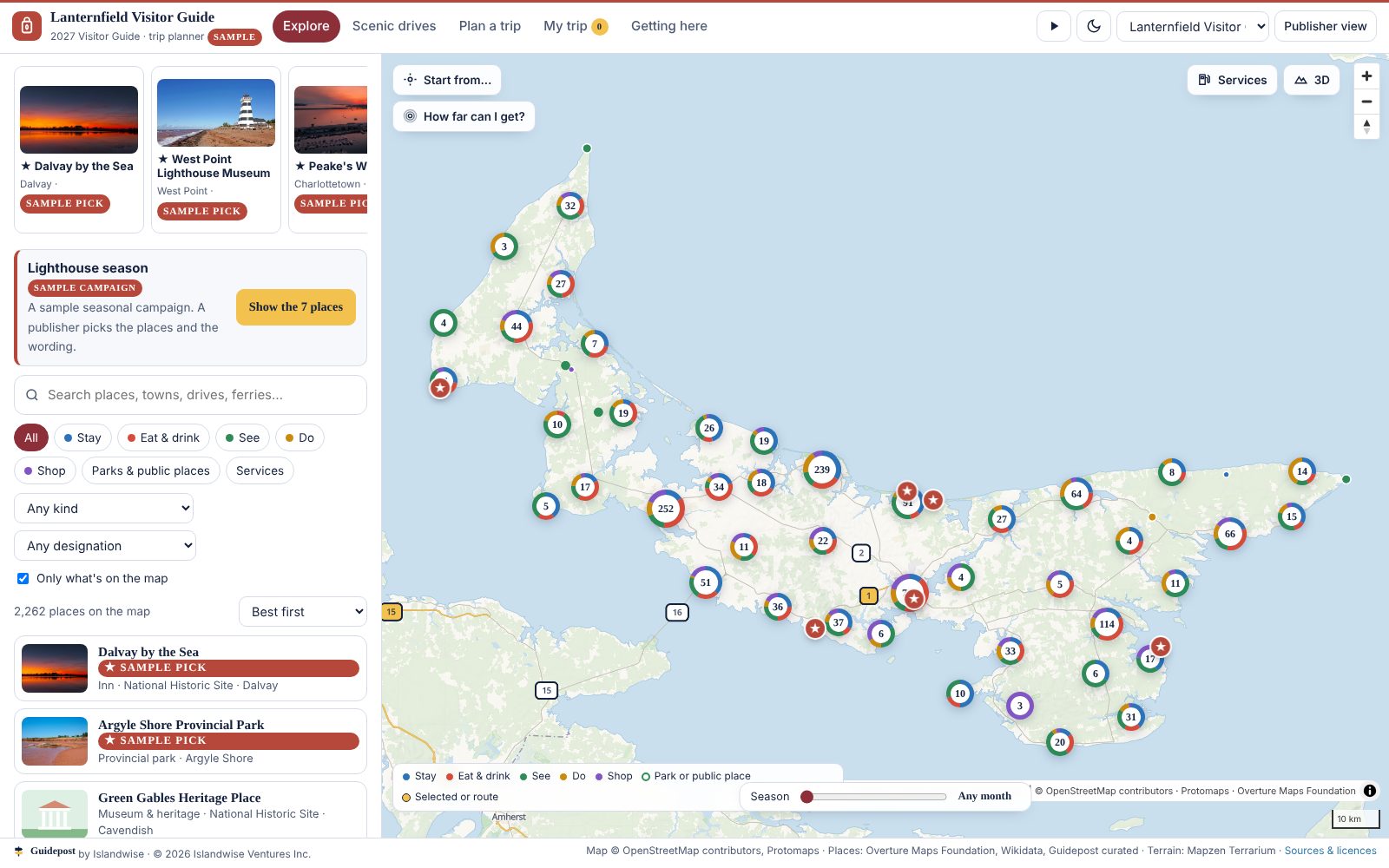
The map under an invented sample brand, Lanternfield Visitor Guide, showing only Prince Edward Island in the brand's colours with a seasonal campaign banner
The planner switched to Lanternfield Visitor Guide, an invented sample brand. One settings file changed the name, logo, colours, province, picks and campaign.

On your website

Already have a website? Keep it.

Guidepost is not a new website. It is the map and planner that goes inside the one you have, with one line of code. Your site tells visitors what there is. This shows them what is near what, how long the drive is, and builds their days.
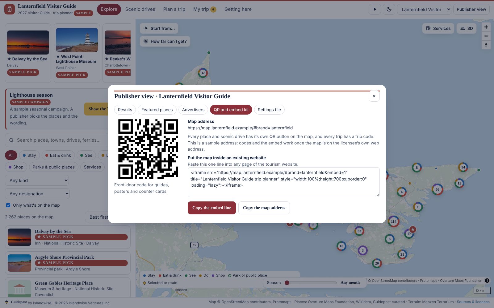
The QR and embed panel for a sample brand, with a QR code and one line of embed code
A QR code for any place, drive or trip, and the one line that puts the planner on your site. Sample brand shown.
What comes with it: the embed code, QR codes for your guide covers and counter cards, and a launch kit with a poster, counter card, social posts and a staff guide.
What it never does: invent hours, prices or reviews. Ferry sailings and tide times link to the operators and the official tables.

See it working, set to your region

The working planner isn't open to the public. We show it live on a short call, with your region on screen, and then give your team an access code so you can try it yourselves.